Welcome to my first bio-blog, in which you'll read about my travels in Iceland, where I hiked the Laugavegur and Fimmvörðuháls trails and traveled across the southern part of the country. You’ll read not only about my experience, but also get some tips in case you plan on going there, plus, of course, you’ll learn about some of the country’s wildlife and their ecology, as well as about the current state of Iceland’s natural world. It’s up to you how nerdy you want the article to be – if you prefer it to be just a travel blog, that’s what it is, and if your brain craves more knowledge, you’ll get to choose which parts you wanna learn more about. So get your brain ready!
SIX DAYS IN ICELAND
HIKING AND DRIVING ACROSS THE SOUTH
CONTENT:
Ladmannalaugar
Laugavegur, Day 1
Laugavegur, Day 2
Fimmvörðuháls
Roadtrip
When you plan your trip to Iceland, it’s important to know when’s the best time to go:
Is it warm enough?
Are the puffins still there?
Is the volcano near the airport still active?
Is the Covid-19
situation OK in the country?
Well, the last answer was a no, but knowing that I’d spend 99% of the time in nature and I fulfilled all the criteria to avoid quarantine, plus, in hindsight, the weather was absolutely perfect, I truly picked the best time to go. Even puffins started leaving soon after I had left.
Just like any other part of the year, when arriving in Iceland in mid-August, the weather can be quite unpredictable, so you can’t expect a warm welcome. I got a fiery one from a special place just a 35 minute drive away.
Fagradalsfjall, the volcano that erupted in March 2021 and has been putting up a show for months thereafter, was clearly visible from the plane. I landed exactly in the middle of the short stretch of time at night when it was actually dark (polar days were already over), so I could marvel at the neon-orange lava flow from the window.
DRIVING TO HELLA
Though you’d never call the condition of the car that we traveled with mint, getting it was a terrific last-minute choice – it saved us a lot of money, since my friends who work on Iceland bought the car for about as much as just a week of car rental in the country.
The car was parked in the middle of a circle-shaped neighborhood in Reykjavík, open, with the key somewhere inside. Rusty windscreen wipers, unopenable trunk door and a thick layer of dust? No problem, the car worked.
So what was our next mission now, at 2 AM? To figure out what to fill the empty tank with, what kind of motor oil to get and whether it’ll survive the week. We truly had doubts a couple of times during our trip, when the car just wouldn’t start. Turned out it was only a part of the accumulator that kept falling off, and you just had to put it back every now and then. No biggie.
TIP NO. 1
Fill your thermo bottles with hot water at the local gas station (for free)!Staying warm is key so keep in mind that asking for hot water is no big issue. Perhaps it was just our luck, but the people we met during our trip were all incredibly friendly and helpful. The gentleman who works at the gas station we went to really set us off to a nice start of our journey with his awesome attitude. Not only did he give us tips about all that the car may need, he filled our thermo bottle with boiling hot water, stocked us up with paper cups and even offered to give us some free tea for our hike. He also warned us about the biting insects that caused a really gnarly allergic reaction on his arms and threw in a few good jokes. Luckily, we didn’t come across those pests, although we later saw that many people truly chose to wear a head net hat during their hike. So, perhaps this is tip no. 2 if you often fall victim to insect bites?
The weather was really gloomy in the west. It looked cold. It felt cold. It was cold. We drove to Hella across lava fields covered in gray clouds. I was surprised to see many trees along the way as they are typically really rare there.
TIP NO. 3
If you plan on doing a lot of driving and you decide to rent a car, get an SUV.The road was empty and we had a lot of time before our bus’s departure to Landmannalaugar, so we decided to take a detour around the Flói Nature Reserve and to the town of Selfoss. What we did not expect was the road to turn to a gravel road – really not ideal for the type of our car – and it just went on and on, laid with large and sharp stones that Adrian had to maneuver around. Right before we were ready to turn the car back around in fear of blowing a tire, and just forget about the detour altogether, the road turned into a proper asphalt road again and we reached Flói.
We did not stop to check out the local avifauna, though, because the road to Selfoss from there was closed. Damn. You don’t have that many roads in Iceland… so… yup, another detour! And quite a long one, not even Google Maps knew where we were going.
The birds we did see, however, were Arctic terns (Sterna paradisaea), perhaps the most unpopular birds in Iceland due to their incredibly aggressive nature (they're very territorial), yet one of the best fliers on Earth. Your average Icelandic Arctic tern will fly almost 70,900 km a year between its wintering and breeding grounds!
During our detour we drove past a village called Stokkseyri. It was eerily empty. As we continued an even eerier image opened up before us. In the grey morning light, a giant white vacuum cleaner by the ocean. Eh, the Knarraros lighthouse, I mean. Around it, a few Icelandic horses, the country’s only breed of horse.
Our fears became reality when the road switched to gravel again. And it was full of holes and sharp rocks again. The car was already in bad shape. It was rusty in some places, its engine did not sound healthy and, well, the orange “check engine” signal was making us guess what the problem could be from the very moment we left the gas station, so we really hoped it would pull through. Luckily, it did.
We got to Selfoss, we got to Hella, parked at the long-term parking spot and instantly passed out. Since we both traveled after finishing our shifts at work, we needed some sleep before we said goodbye to the car for the next four days.
LANDMANNALAUGAR
TIP NO. 4
If you don’t have a car and especially if you wanna do the Laugavegur trail, take a bus from ReykjavíkWe took the Reykjavík Excursions bus from Hella to Landmannalaugar. It's no typical bus but a proper off-road vehicle! It drove past complicated rocky terrains, rivers and dusty roads (another good reason for wearing a face mask in the bus apart from protecting yourself from covid) and the landscapes were slowly changing from large fields into magnificent wild and rough nature.
Dramatic rocks surrounded by lush greenery, sharp peaks of the mountains in the background and suddenly, the Tindfjallajökull volcano in the distance. Sheep grazing all around. Then the Hekla volcano. A large herd of horses being led to Landmannalaugar by a few people. A few hours later we were almost there. It was noon and we were still dead tired.
TIP NO. 5
Camp! And be well equipped for itCamps in Iceland, especially the ones along the Laugavegur trail offer cold drinking water, warm water for showers (costs about 4-5 EUR), snacks (for reasonable prices, even beer), some have huts where you can get warm (and fairly expensive) food, and most of them also have shelves or boxes full of free stuff, such as half-empty gas cans, instant food, soap and shampoo bottles or other useful stuff. Another plus is the price for camping – most campsites cost 12-14 EUR per person per night. Oh, and you can pay by card. Everywhere.
Be sure to bring a water-proof tent, collect some rocks and place them around your tent to break the wind. Pack a good mat and definitely bring a warm sleeping bag. That’s something I didn’t really think through and had to sleep all dressed up, even with my hat and my scarf on. Temperatures can easily drop below 4°C at night. Not to be underestimated.
We built our tent, prepared a nice front yard – we dragged a piece of log there (perhaps the only piece of log in the camp, really. Where did it actually come from? There are no trees anywhere nearby, let alone such thick ones!) to use as a bench for lunch, dinner and breakfast –, and decided to sleep a little longer to gain more energy for our first hike.
TIP NO. 6
Sunscreen, baby!The weather was awesome. We had blue skies and it was warm, but not tiringly warm or humid. Just right, with a light breeze refreshing us every now and then. We did, however, forget to bring sunscreen. The forecast showed rain just a few days before we set off, how could we have known! And well, after a few days, we felt it.
Our first plan was to find the hot spring, but we didn’t have to search for long. The People’s pool, as they call it, is right at the campsite. So we set off to check out the Laugahraun lava field instead. It was formed sometime around the year 1477 and is laid with large and shiny obsidian rocks that give the few hundreds of meters of the trail a silver gloss as they reflect the sunlight.
As we walked past the field, we got to a long valley stretching between the Suðurnámur mountain and Brennisteinstalda, an 855 m tall volcano, the name of which translates to “sulfur waves”. The green valley was full of the fluffy cottongrass and contrasted with the black and grey color of the lava field, the brown mountain on the right and the colorful volcano on the left. Brennisteinstalda is possibly Iceland’s most colorful mountain. Sulfur gives it yellow tones, moss and algae give it green tones, it’s also blue and grey from lava dust and red because of iron. We decided to turn left toward the smoke emanating from the hillsides. There were several patches of hot wet yellow-green rocks along the trail that had a strong stench of sulfur. All around us, steam rising up from the rocks.
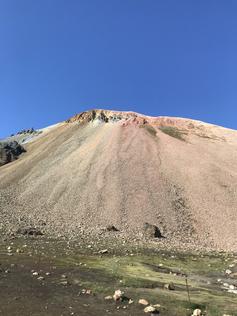
This was already the Laugavegur trail and we didn’t want to continue the way we would go the next day, so we decided to turn back and then right again and climb the Blue Peak, or Blahnjúkúr. After another few tens of meters among the shiny obsidian stones, we arrived at a stretch of bright green grassland leading to a terrain that abruptly lost all of its greens and made me feel like I was walking on Mars.
Pale red and light brown rocks lying on an almost perfectly level ground, surrounded by round brown hills with stripes of white (snow) and neon green (moss), and a single dark brown sharp rock standing right in front of us like the remnant of a long-lost crashed spacecraft. On its left side, the trail leading to Blahnjúkúr.
We had to cross a creek that was about ankle-deep and perhaps two or three meters wide. Pretty cold, too. Then we reached the side of the mountain and up we went for another 40 minutes. The Blue Peak is completely barren, with only a few species of plants growing on its nutrient-poor rocky surface, plants that we’d see almost everywhere we went: catchflies, sea thrifts, saxifrages and mouse-ears…
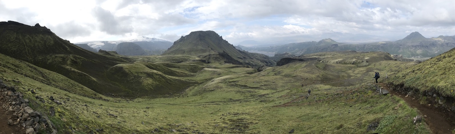
We reached the top and were there completely alone, some 940 m above sea level. There, Landmannalaugar opened itself up in its full beauty. The edge of the lava field, the campsite next to it and the breathtaking landscape. Just see for yourself!
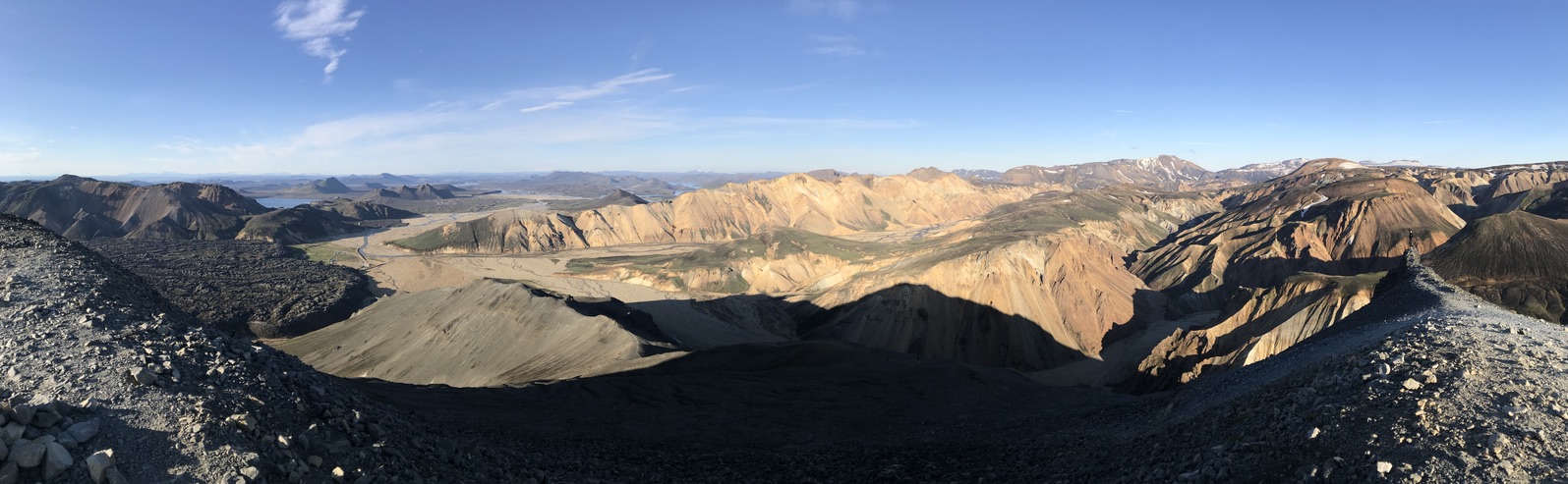
We spent quite a while there taking pictures, making videos and just enjoying the view. While long days are highly beneficial when you’re doing long hikes, we really wished for a nice sunset with this view. Adrian was taking pictures of us with his GoPro9 and almost fell off the side of the mountain because he “forgot he was standing there”. A few more shots and we were ready to go down and check out the hot pool.
The pool is shallow and the water is lukewarm at the entrance, so you have to go deeper and mix with the crowd in order to reach the really hot areas. It’s a wonderful natural pool divided into two parts with water hot enough for just chilling in it. You’re surrounded by rocks covered in moss and liverworts, colorful stones and the sound of wilderness. That is, until some locals bring a bluetooth speaker and beers and start a hot pool oldies party. Ah, pure nature.
So many activities and it still hadn’t been a full day since I arrived in Iceland! It was time to get proper rest before the first day of our hike.
LAUGAVEGUR - DAY ONE
The Hot Spring Route
The night was incredibly cold and I really regretted not investing into a warmer sleeping bag. We had a decent breakfast (instant milk rice, yay!), prepared some snacks, packed our tent, said goodbye to our camping neighbors (and, at the same time, asked for some sunscreen donations), goodbye to our log and were quite surprised how late it was already. We left the camp a little before 11 AM and made sure not to stop at any part of the trail that we've already seen. Apart from the cottongrass valley – the light was nicer for a photoshoot at this time.
Laugavegur translates to “hot pool route”, and it’s named for an obvious reason – there’s a ton of them along the trail, mostly too hot for a bath. There are plenty of travel blogs that will describe how to, when and whether to do the Laugavegur trail and all of them agree on one thing: the beginning of the trail is the most difficult. If, however, you think this could mean that the rest is easy, do I have news for you!
TIP NO. 7
Windbreakers FTW!First of all, I’d say weather is crucial. We were very lucky to have such nice weather and felt kind of warm, actually. The wind got stronger from time to time and then my windbreaker came in handy. And boy, it really can get strong. Our friend Martina hiked the trail a week later, and though at a different location along the trail, the wind got so strong she could barely walk! She hiked Laugavegur toward the end of the season and you definitely shouldn’t decide to go later than late August if you aren’t skilled enough.
Once you get past the colorful and raw rocks of the Brennisteinstalda volcano, the trail starts to look like a really long and extra bumpy bread roll, with some parts baked just enough to be golden brown, others burned to char, even steaming at places. Some bits have extra icing (snow and ice), others perhaps a bit of mold (green moss, algae, grass and other plants, blue and yellow pools of hot water). To get to a higher elevation, you must first go downhill a little. The bumps only really end somewhere before you pass the Grashagakvísl river to get to the Álftavatn lake, like we did. And that’s over 24 km.
The views are unforgettable as the trail changes into a new world almost every 20 minutes. We couldn’t help ourselves and just go “wow” everytime we saw something new.
First it’s the large lava field at Landmannalaugar with huge pieces of obsidian rocks. Then it’s the colorful Sulfur wave with smelly steams of sulfur. Once you pass those, you go uphill and reach a saddle with red rocks. As you continue, red turns to golden brown, even green for a while, then back to golden brown as if you’re walking on a huge camel’s back. Then, it’s chocolate brown with white spots of snow, as if you’re walking on a huge cow’s back for a change. Further on, the golden brown hills get a shade of greyish green, when suddenly you're walking by a creek of boiling hot water, splashing out into the air from the side of the hill. Across the trail from this site, a carpet of neon green moss stretching between two hills. As you walk on, the scenery changes to a vast silver field of obsidian rocks glistening underneath the sun. The trail is not easy to keep track of here and, from time to time, you may wander off slightly to the side until you spot the next trail pole in the distance.
Here we saw a cairn with a plaque commemorating a young man who got caught in a blizzard and lost his life, so close to the first hut and camping site on the trail that we would pass, Hrafntinnusker.
This camp is perhaps the rockiest and coldest of all the camps found along the trail. There's a hut with bathrooms, a latrine and plenty of space for tents with wind-breaking rock circles built for each tent. We decided to celebrate our arrival here by getting a bottle of cola at the reception. Most hikers will stop here and explore the area for the rest of the day, especially if they hike from south to north. We decided to continue to Álftavatn.
There were more and more patches of snow around us, as well as more patches of moss, alpine flowers and creeks rich in algae. With more snow came colder temperatures and stronger wind and we knew why – a glacier peeked out from behind the hill on our left, and as we continued, a massive, perhaps 15-20 meters tall wall of rock-hard snow, a warm creek steaming below it.
The wall of snow continued along the hill we passed on its right side, and the trail turned into a dusty desert-like terrain, with a cloud of steam rising up ahead. The steam rose from a hot creek and several small puddles boiling beside it. One of them was truly strange – it looked like a puddle of deep-grey, thick paint. With patches of this color decorating the trail, it really looked as if we were walking through a construction site and someone just spilled some paint or concrete on the ground.
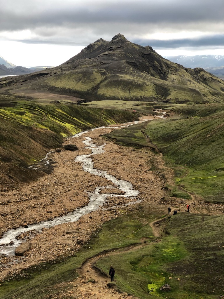
And then, we saw it, the creek flowing to form the Grashagakvísl river and leading to Álftavatn, the lake reflecting the last bits of sunlight we would see that day in the distance.
More water, more plants! And I stopped to look at a truly familiar one – Pinguicula vulgaris, also known as the common butterwort. These plants grow on nutrient-poor surfaces, such as the rocks along the trail, and while they don't really depend on it in order to survive, these plants are carnivorous, trapping small insects on their glandular leaves and digesting them for extra nutrients.
As we hiked across humid rocky terrains, I often stopped to marvel at the tiny plants growing on the edges of the trails. One of those was the common butterwort (Pinguicula vulgaris) with its beautiful purple flower blooming high above its dangerous leaves arranged in the shape of a star. Dangerous if you’re a small insect, that is.
Why dangerous? It might not look like it, but the plant is carnivorous! You can’t expect to get many nutrients from soil in these areas, especially if you grow on volcanic rock, so what's another way to get nutrients? Eat.
When insects (mostly tiny flies) land on the butterwort's glandular leaves, they get trapped in its mucopolysaccharide slime. The leaves then curl upward from the sides and the plant starts to digest them.
What lures them to the leaves? Perhaps the glistening appearance of the droplets on the leave’s glands, UV patterns or a fungus-resembling odor. Carnivory, however, isn’t crucial for the plant’s survival, but enough sunlight is, so you won’t see the butterwort grow in the shade of another plant. Too much prey can even damage the glands and cause the leaves to rot. The rotting leaves or leaves that are covered with insects so much that they cannot photosynthesize properly are quickly replaced by new fleshy traps, waiting for those extra nutrients.
The flower, blooming in a safe height so as to (perhaps) minimize the risk of injury for possible pollinators, attracts bees, butterflies and tiny bugs to have a sip of its nectar and pollinate it while the tiny corpses lay below, rotting away in their sticky, green grave.
We soon reached the Grashagakvísl river, tired after almost 9 hours on foot. The river? Not quite tired – it was wild and rich in water, could have been about knee-deep. After a few stressful minutes of figuring out how to cross it and an unnecessary mental breakdown later, with one foot wet and no more energy to spare, we reached the Álftavatn camping site.
It was pretty dramatic as it was getting dark, the weather was gloomy and cold; the lake was quiet, surrounded only by grass and rocks. No trees, no nothing. Just dark, grey, quiet.
Apart from camping here, you can stay in the hut (gotta book it in advance, as is the case with all huts along the trail) and enjoy the atmosphere in the cosy restaurant, with live music, warm food and perhaps even a drink. You can buy a token with a QR code for a warm shower, though we later figured out that the water was also warm without the need to use code. It sure felt nice to have a hot shower after those 24 km.
Dinner, toothbrushing, sleep.
LAUGAVEGUR - DAY TWO
We woke up to a cold morning, and it was drizzling. We put on several layers of clothing, packed our stuff, covered our backpacks to protect them from rain and we set out as early as we could – we knew this day would be longer than yesterday.
TIP NO. 8
Trekking poles and sandals will help you cross the riversThe first few kilometers were pretty crowded and we soon found out that it's getting really warm to have all these layers on. The landscape was dramatic, black with neon-green moss, grasses and ice-cold rivers to cross. The first one was about ankle-deep and the only thing that made this crossing unpleasant was the temperature of the water and the sharpness of the stones in it. Sandals would've been handy. We then crossed another campsite called Hvanngil, less than 4 km away from Álftavatn.
First it’s the large lava field at Landmannalaugar with huge pieces of obsidian rocks. Then it’s the colorful Sulfur wave with smelly steams of sulfur. Once you pass those, you go uphill and reach a saddle with red rocks. As you continue, red turns to golden brown, even green for a while, then back to golden brown as if you’re walking on a huge camel’s back. Then, it’s chocolate brown with white spots of snow, as if you’re walking on a huge cow’s back for a change. Further on, the golden brown hills get a shade of greyish green, when suddenly you're walking by a creek of boiling hot water, splashing out into the air from the side of the hill. Across the trail from this site, a carpet of neon green moss stretching between two hills. As you walk on, the scenery changes to a vast silver field of obsidian rocks glistening underneath the sun. The trail is not easy to keep track of here and, from time to time, you may wander off slightly to the side until you spot the next trail pole in the distance.
We stopped to use the bathroom and overheard an international group of tourists react to the croaking call of a raven.
“Was that a chicken?”
“Probably a frog.”
“That’s a raven.”
“A raven? Those birds are gnarly.”
Safe to say you won't find many chickens in a national park, and whatever croaks in the Icelandic wilderness is definitely not a frog – the country has none of those.
We continued the same way as those and a few other hikers did. The next river had a bridge, and we really wouldn't wanna have to cross it as it was deeper and wilder. The river we had to walk across, though, was a bit wider than the first one, and its banks were decorated with the national plant of Greenland, Chamaerenion latifolium, the river beauty.
The dwarf fireweed, also known as the river beauty is a circumboreal perennial plant, common in the Arctic and subarctic areas of the northern hemisphere. Its leaves and shoots are edible and are said to taste like spinach.
The plant is an important source of nutrients for the Inuit, and it’s the national plant of Greenland. There, it’s called niviarsiaq, which translates to “young girl”.
The tourists crossed the river with us and one of them had a thermometer in his watch. He was able to tell the water was 4°C. Not really pleasant to cross.
The next long kilometers took us across vast flat lunar landscapes of rock and dark sand, with no signs of life other than a Silene plant here and there, distant, dramatic hills covered in moss and grasses. Then rivers, naturally covered in greens, then more vast nothingness and silence.
Some of the rivers were truly powerful. Brutal and greyish-brown. The fields of Silene patches then changed to a field of rocks that looked like chocolate-chip cookies, surrounded by smooth, untouched black sand, upon which patches of grass stretched their roots to collect as much moisture and nutrients from the environment as possible. We soon discovered that we were far ahead from the other hikers and now completely alone, briefly joined by some wagtails flying by.
A glacier peeking out in the distance, Mýraldsjökull, a car parked on a hilltop and then soon, the next camp – Emstur / Botnar. This camp has several huts and a small area for building your tent. We made use of its large tent with tables and benches and cooked some lunch. By now, we were getting close to Katla, one of Iceland’s most famous volcanoes and from this point, the barren land was turning into a green landscape full of life.
The first conspicuous plant growing along the creek below the campsite was the Norwegian angelica (Angelica archangelica), a really tall, medicinal and edible plant.
Past this creek, the landscape slowly turned greener and greener, with mosses, grasses, heath, small shrubs and later even trees. Yet, before the walls of the green, wildlife-sustaining world of Þórsmörk opened before our eyes, we encountered more geological beauties, such as massive basalt cliffs and a brutal gorge hosting a powerful river with concrete-grey water, flowing with a chilling force. Truly, looking down at it from the bridge was simply humbling.
The first trees you’ll come across when you hike down the Laugavegur trail are just a few inches tall. They’ll be the dwarf willow, woolly and arctic willow, the latter of which can grow to up to 2 meters in height, whereas the first one is considered to be the world’s smallest tree.
Iceland isn't really known for its trees, yet many areas that seem totally void of trees actually have one hiding in plain sight.
What's this fluff in the grass? Perhaps a sheep walked by and left something behind? Why, it's the world's smallest tree - the dwarf willow (Salix herbacea)!
Also called the least willow, snowbed willow, this species only grows to 1-6 cm in height. And although it doesn't really look like a tree, it does produce a single woody stem with lateral branches so, botanically speaking, it is a tree. It's typical in the cold northern regions of our planet.
The dwarf willow is perfectly evolved to survive the harsh arctic climate - it's tiny, has broad leaves to maximize photosynthesis and it can reproduce both sexually and asexually by cloning itself. Cloning, however, comes at a cost, genetic that is - with more clones comes lower genetic diversity, which, in the long run, is dangerous.
In the Czech Republic, where I live, both existing populations of this species are purely female, so they're unable to produce seeds and colonize new areas, making the dwarf willow critically endangered in this country. The situation is very different in my homeland, the neighboring Slovakia, where the plant is classified as least concern, yet it is still protected by law.
As you enter the woods of Þórsmörk, you’ll also see plenty of ferns, birches, even some pines, blueberry bushes and a ton of horsetails, even really alien-like without side-branches, growing on the dark sands along the trail.
The heathland just before Þórsmörk is vast and has a warm feel to it. It hosts one of Iceland’s typical birds, the rock ptarmigan, which we were lucky enough to spot right next to the trail. And with chicks! Adrian could not understand my happiness from seeing a species that, to him, looked like an ordinary chicken. Well, I, on the other hand, was delighted.
Entering Þórsmörk, however, is not for the faint-hearted. We had to cross a river that’s much stronger than the first two were. Much wider. And as for depth, that’s tricky, because you could not see the bottom due to the color of the water. Where we crossed it, it was somewhere between calf- and knee-deep.
It took a while for us to figure out which way to go. More people arrived at the spot, with trekking poles and sandals, so we watched them go and decided to follow those who took the most shallow path. The waterflow was powerful and the rocks tended to move under your feet as you brushed them with your foot, so making sure you kept your balance was key. You don’t wanna fall over with your 20 kg backpack. On the brighter side, you don’t really care how sharp the stones are anymore, especially toward the far side of the river, since the temperature of the water causes your feet to go numb and feel a different kind of pain that you're unable to locate. But soon after that you’re out of the water and the most difficult part is over.
TIP NO. 9
Pack a knee brace or twoBy this time my left knee gave up on me and decided to make itself heard every time I tried to take a step. My ankles were also pretty unstable by the time we reached Þórsmörk. The good thing was that we were almost in the camp.
Walking in the forests of Þórsmörk was rather strange to me, as I’m used to hearing bird songs and other animal sounds in the temperate European forests a lot. Here, however, silence. A single bird appeared here and there. Perhaps a wagtail. But not much more.
The trek was over, and we arrived at the Volcano Huts, where Adrian booked a glamping tent – the best thing you can imagine after those 60 km. A double bed with warm blankets and heating? Say no more.
The campsite is fantastic, with a hot pool (though this time it was just a lukewarm pool), sauna, warm showers, cute elf houses and a restaurant with warm food, a cosy atmosphere, board games and drinks.
The Laugavegur trail ends here, so there are plenty of bus connections you can take to travel back to Reykjavík. For us, the hike was far from over. We still had over 30 km ahead of us.
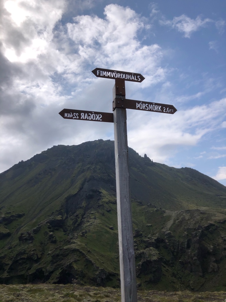
FIMMVÖRÐUHÁLS
The Five-Cairn Trail
One thing we discovered is to never trust the guides when it comes to distances. It’s always longer, mainly because you never really start at the official starting point of the trail. The only thing that we were certain of was that this trail would be the most difficult for us right there for simple reasons: it was our fourth day, we already walked around 72 km and, well, there’s only so much our bodies could take before they started to protest. And they did.
We prepared some snacks from the breakfast buffet and also bought some extra sweets to keep us energized and off we were to Skógar. We knew that the first few kilometers would be the most painful – you must climb 1000 altitudinal meters in the first third of the trail. Yet, there was more to look forward to, and even a little bit more than I imagined.
In order to get to the trailhead, we had to go back a little and hike across another, larger part of Þórsmörk’s forest. It was covered in plenty of trees, herbs and lichens, some of which were huge and leafy, perhaps Peltigera membranacea.
We passed a cave and even saw a pine tree before we reached the last camp at the edge of the forest, Skagfjörðsskáli, separated from the Fimmvörðuháls trailhead by a powerful and infamous river Krossá, which often changes its flow intensity and direction. For this very reason, the moveable bridge that we had to cross in order to get to the other side was moved away from the trailhead and we had to find our way to it through an overgrown trail. About two weeks after we left the bridge could no longer be crossed and you could only cross the river by a jeep or the above-mentioned off-road busses.
One last filling up our water bottles at Básar and up we went around a dramatic black and green gorge, across vegetated hilltops and heathland in the area of Goðaland, where we saw two individuals of a beautiful bird species, the European golden plover (Pluvialis apricaria).
European golden plovers (Pluvialis apricaria) build their nests on the ground and line them with lichens, grasses and leaves, making their white eggs with brown spots well camouflaged in the nest.
Their chicks are precocial and nidifugous, meaning that once they hatch, they're mature enough to move around and feed themselves. They're tiny and helpeless nonetheless, dependent on their parents for at least 25-33 days. Baby golden plovers rely on their amazing moss-mimicking feathers that help them blend in with their surroundings in order to avoid predation.
The arrival of golden plovers to Iceland is always covered by the media - in Icelandic tradition, it symbolizes the beginning of spring. Its nickname in the country is vorboðinn ljúfi, meaning "the sweet herald of spring".
A 19th century poem by the poet Páll Ólafsson reads - Lóan er komin að kveða burt snjóinn, "the golden plover has come to sing away the snow".
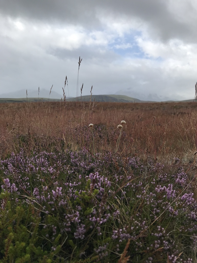
We reached a steep hill covered in dwarf willows, butterworts, dandelions, Silenes, mouse-ears and other tiny plants, where we met a ton of hikers coming down the opposite way, almost reaching their destination, Þórsmörk.
“Hello, are you coming from Skógar?” we asked.
“Hey, yes,” a man answered.
“At what time did you leave,
roughly?”
He stopped to think. “I think sometime before 7 AM.”
“Oh, ok. We’re on our way there now”, we said.
The man
looked at his watch. Seeing that it was already 2 PM, he said “Oh, well… good luck.” And boy, did he know what he was talking about.
Hiking up this hill was long and tough, but the views from the trail were like a painting. Green, moss- and grass-covered hills before and beneath us, the river Krossá flowing on in the distance to support the 100 km long river Markarfljót, and one of its main sources of water, the glacier of Eyjafjallajökull, standing majestically above.
Once we climbed the hill, the trail lost all of its greens. We entered another lunar landscape. Nothing but dust and rocks and the next, bigger glacier covering the volcano Katla, Mýrdalsjökull on our left. This glacier also supports the unpredictable river Krossá.
We wouldn’t see the sun that day anymore.
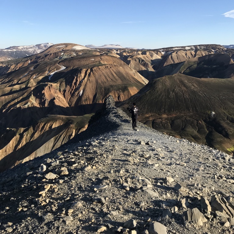
The trail on this flat hill led us to a narrow ridge made up of cube-shaped rocks. This part of the trail requires both of your hands to be free. We had to hold onto a chain connected to the rocks, and unfortunately, one of the connections was broken, so the chain was sort of loose. We had to hold onto it nonetheless, because if we tried to climb the rock itself, pieces of it would break off and stay in our hand. Luckily, though, this part was short.
Skógar was still about 18 km away and we had more climbing ahead of us. Dark, almost black rocks and patches of snow and the trail leading to a thick grey cloud.
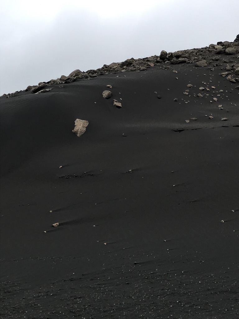
Eyjafjallajökull isn’t just the name of the glacier but also of the volcano it covers. You may be familiar with this name because it made the rounds when it erupted in 2010 and caused a lot of trouble, especially for airlines. Once we were up, we found ourselves between the two glaciers – this is the pass called Fimmvörðuháls. On it, we walked on the 11 year-old terrain created by Eyjafjallajökull, called Goðahraun, which is about 10-12 meters thick.
We walked vast fields of snow, rock and volcanic ash. Suddenly, we found ourselves walking on an ash-covered glacier, minding every step so as to not fall. Soon after 6 PM we reached a hut which had wi-fi and a toilet. After a quick snack we continued downhill, as we still had 10 km to go.
The terrain was slowly turning green again and for a good reason – we reached the river Skóga. The river has 27 waterfalls and the trail beside it leads you all the way down to Skógafoss, the final waterfall on the river Skóga and one of Iceland’s most popular tourist spots, where the Fimmvörðuháls trail ends.
Going south on this trail has one downside: all of the pretty stuff is behind you so you have to keep looking back. Our wows at each of the waterfalls got quieter the further we went as we were tired, it was getting dark and we were still so, so far away from the camp.
Sheep along the trail – perhaps a sign of getting closer to civilization? And yes, there we saw it in the distance. The ocean and fields surrounding it.
Twenty-seven waterfalls, and each more majestic than the other. The waterflow eerily powerful and the walls of its gorge hosting a ton of seagull nests. At 10 PM we reached the camp, built our tent in the dark and cooked a quick dinner. That was it – we hiked 105 km.
Our next mission? Find a way back to the car and hope that it still works.
Going south on this trail has one downside: all of the pretty stuff is behind you so you have to keep looking back. Our wows at each of the waterfalls got quieter the further we went as we were tired, it was getting dark and we were still so, so far away from the camp.
TIP NO. 10
Most places accept cards, so you can go cashless for most parts of your trip. But always keep a few hundred ISK in coins just in case you need to take a shower in a camp where the water only flows when you put coins in a little box beside the showerbox.WEST TO HELLA AND EAST TO VATNAJÖKULL
Roadtrip Across Southern Iceland
Soon after breakfast, we packed our stuff and went back to check out Skógafoss real quick. This was already part of Iceland’s such spots that were overcrowded by tourists who can just park their car nearby and walk two minutes to take a nice picture with the wonders of mother nature. We, of course, took some photos, too, got pretty wet from the waterfall and all excited for my first ever hitch-hiking.
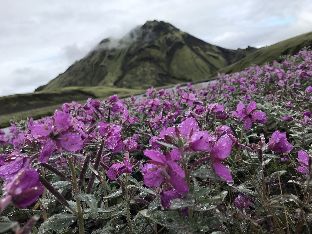
The area around Skógar is heavily overgrown by the nootka lupine (Lupine nootkaensis), a plant that is about as beneficial to the eroded Icelandic landscapes as it is detrimental due to its invasive nature. It had lost its pretty purple-white flowers already and was now just a bunch of green leaves and brown fruits homogenizing the area.
The nootka lupine is not native to Iceland, nor to any other European country. In fact, it was brought to Iceland from Alaska in 1945 to help combat soil erosion, which has been causing serious problems in the country.
When the first settlers arrived at Iceland, about 65% of the the country’s area was covered in vegetation. Over more than 1100 years of slash-burn agriculture and overgrazing, green cover has gone down to just 25%, and the wind has kept blowing the country’s soil into the ocean.
From the 1970’s, lupines were actively dispersed across the country and released into nature. People hoped the plant would halt erosion and, as a legume, to fertilize the country. Like other legumes, the nootka lupine also hosts atmospheric nitrogen fixing bacteria in its root nodules. This is something most plants cannot do and they therefore depend on nitrogen available in the soil in a different than atmospheric form. Because of this, the lupine can create good conditions for other plants to grow in the area it inhabits.
Although its introduction really helped make the soil more fertile, it came with a price. The lupine spreads exponentially and is invading Iceland’s scenic greenery, quickly turning the landscapes into a sea of purple, then brown with the onset of fall. In the past years, locals have been trying to eradicate the plant in places where it causes more harm than does any good, but some believe it’s past the point of no return.
The coronavirus situation in Iceland was pretty bad at the time so we expected it would take long until someone stopped to pick up a couple of hitch-hikers. The sun was hot and even Adrian said that he hadn’t felt this warm in Iceland.
After about 20 or 30 minutes an SUV stopped. A lady quickly got out of it and started making space for us in the back. She and her husband were from the English countryside and were on their way to Landmannalaugar, so they took us straight to Hella where our ride was waiting for us.
We did not even manage to introduce ourselves as we started talking about our experience at Landmannalaugar and gave them a bunch of tips for stuff to do and see there. They were lucky enough to have their own car so they could drive around and see more beautiful sights that would take us hours to reach on foot. The couple were definitely some of the friendliest (duh, they gave us a ride!) people we met during our trip and we agreed on one thing, as the gentleman driving the car said: “What I really love about traveling in Iceland is that you meet so many nice people, like yourselves.”
TIP NO. 11
Shop for cheap (i.e. normal prices) groceries at BónusForty minutes later and we’re there, dropped off right beside the blue Toyota Corolla! And it worked! A quick stop at the local Bónus and a nearby souvenir store and we drove back east to see more spots.
The majority of my last two days in Iceland were mostly spent driving, so here’s a quick summary of the remaining sites we visited:
Seljalandsfoss – a popular massive waterfall that has a path leading all around it. The cliff is covered in ferns, algae, mosses and liverworts. Near it is Gljufrabui, a waterfall that is hidden inside a small canyon.
Dyrhóaley – a windy promontory and the southernmost part of mainland Iceland, with beautiful cliffs and, most importantly, puffins! You haven’t really visited Iceland in the summer if you haven’t seen the little brothers!
The Atlantic puffin’s (Fratercula arctica; fratercula = “little brother”) Icelandic population comprises about 8-10 million individuals - 60% of the world’s Atlantic puffin population!
While it’s not difficult to spot them there in the summer, their winter whereabouts are somewhat hard to pinpoint. Puffins spend about 8 months at sea and only return to land to breed. Also, they lose their bright coloration as winter approaches, when their beaks shed and turn grey. How do they survive so long at sea? Their feathers are waterproof and they can drink saltwater!
Puffins are monogamous and the birds usually return to the same spot to rear a single chick every year, with the same mate. Their average lifespan is almost 31 years!
You’ve surely seen pictures of puffins with a ton of fish in their beak. Usually it’s about ten but one individual was spotted carrying 62 fish! How the heck? Well, their no. 1 prey is the sand eel or sand lance (seen in the second image), and puffins have special adaptations that help them keep the fish safely in their beak - a spiny tongue and upper palate, plus an extra bone in their jaw that prevents the fish at the tip of their beak from falling out.
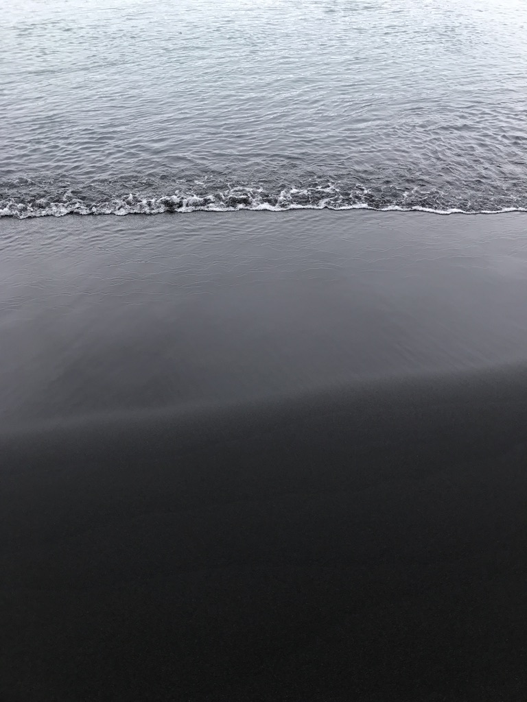
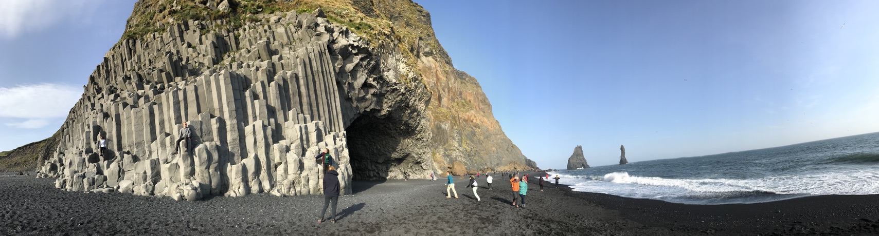
Reynisfjara, the Black Beach – the name is self-explanatory, but besides being one of the most dangerous beaches in the country (look out for stealth waves that can appear unexpectedly), it also has some of the most beautiful geologies I’ve seen – enormous basalt rock formations that you may be familiar with from the Game of Thrones, if not from tourist promos. Oh, and of course MORE PUFFINS!
Diamond Beach and Jökulsárlón, the Glacier Lagoon – about as dangerous and dark as the Black Beach is the Diamond Beach, covered with chunks of ice washed ashore from the sea. How do they get there, you may ask? From Jökulsárlón, the Glacier Lagoon, where pieces of ice from the Breiðamerkurjökull outlet of Vatnajökull, Iceland’s largest glacier (covers about 8% of Iceland’s surface!), break-off and float out to the sea, only to be washed ashore again. Quite frankly, if you don’t count Russia’s Severny Island ice cap, Vatnajökull is the biggest glacier in Europe. The area also hosts plenty of wildlife. Apart from the typical birds, such as gulls, jaegers or terns you may also see whooper swans, snow buntings and seals!
Visiting Iceland is definitely something most of us have dreamt of, and getting to know the country by hiking it is perhaps the most intimate and rewarding way. So, if you decide to go, try to make it less comfortable and more adventurous - it's absolutely worth it. But bear in mind, the climate is harsh and can be dangerous even in summer. So travel prepared.